September 27, 2024
The datasets are used by organizations throughout the region in comprehensive plans, research projects, land use analyses, and other planning projects.
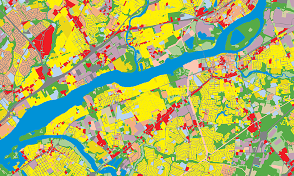
DVRPC’s 2020 and 2023 land use datasets have been released to the DVRPC Data Center. Since 1990, DVRPC has produced a GIS Land Use layer for its nine-county region every five years. The land use layers are consistently one of DVRPC’s most popular data resources. The datasets are used by organizations throughout the region in comprehensive plans, research projects, land use analyses, and other planning projects.
The land use files are based on digital orthophotography created from aerial surveillance taken in the spring of the land use file year. The 2020 and 2023 datasets update the Enhanced Land Use Layer, first developed for the 2015 land use dataset. The 2020 and 2023 updates are consistent with the original 2015 Enhanced Land Use Layer inventory and land use categories.
The files categorize the region’s land according to what activities or uses that take place on it. Categories include Residential, Industrial, Transportation, Utility, Commercial, Institutional, Military, Recreation, Agriculture, Mining, Wooded, Water, and Undeveloped. Most land uses are also broken down into several sub-categories based on sub-uses. Examples of subuses include single-family detached residential, office commercial, or medical institutional uses. Land may also be categorized as “mixed-use,” meaning more than one use occurs within a building or development. “Mixed-use” subcategories exist for primarily residential, commercial, and industrial uses.
An analytical data report (ADR) providing further analysis on the land use files is forthcoming. The report will provide regional, county, and municipal-level land use data and compare it with previous years. In the City of Philadelphia, information will be provided for each of the city’s 18 planning districts. The report will also include county land use maps and further statistics on land use subcategories and residential densities.