The High Street corridor is the Pottstown Area's primary small business commercial corridor and main street. Multimodal access, efficient traffic circulation, and beautification along this corridor are important to the livability and economic vitality of the Pottstown region.
The High Street Corridor Study is two-year project requested by the Montgomery County Planning Commission (MCPC) and the Pottstown Metropolitan Regional Planning Committee (PMRPC) to develop multimodal design improvements along the High Street Corridor.
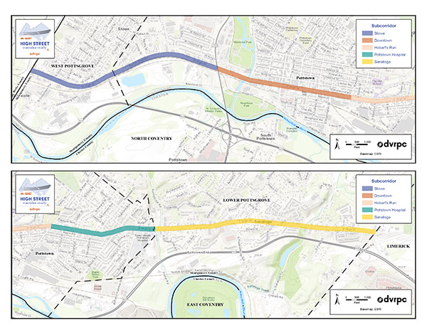
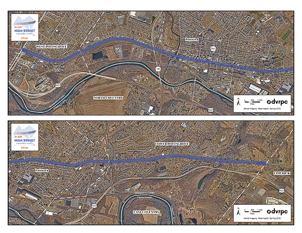
The portion of High Street studied for this project is approximately six and a half miles long and extends from Quarry Road to the west to Rupert Road to the east. The study corridor extends through three municipalities within Montgomery County: West Pottsgrove Township, Pottstown Borough, and Lower Pottsgrove Township. Recommendations included safety enhancement such as midblock crossings, a road diet, and targeted sidewalk completions, as well as aesthetic and placemaking efforts such as gateway treatments, landscaping, and wayfinding.
High Street Subcorridors
The High Street Corridor was broken down into five Subcorridors based on elements such as land use and roadway characteristics in order to prioritize issues and develop objectives for context-sensitive design recommendations. These subcorridors are shown below.